
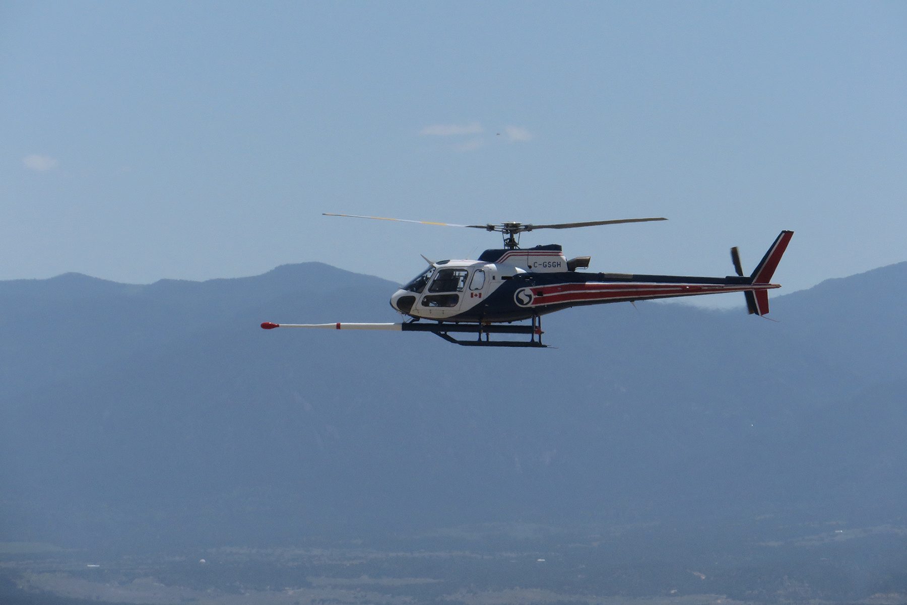
People in Fremont and Custer counties might spot a low-flying helicopter in the skies this summer. The aircraft flies with a single data-collecting instrument attached to the bottom, extending forward like a long stinger.
The helicopter is working with the U.S. Geological Survey and the Colorado Geological Survey, gathering data about Earth’s magnetic field and naturally occurring, low-level radiation.
The research is part of a national project called Earth MRI, which aims to improve knowledge about the geology of the country and identify areas that might have critical natural resources.
Previous mining discoveries made around Cañon City and Westcliffe led to studying this specific area of Southern Colorado, said Tien Grauch, a research geophysicist with the U.S. Geological Survey. For Grauch, it's an opportunity to improve the existing geologic maps using new technology.
Grauch said the current geologic maps of this area show rock formations caused by magma coming up closer to the surface than usual long ago.
“This time frame is a little perplexing in terms of, why did these come up, and what was happening on Earth at that time,” she said. “And it relates to these mineral deposits. [We’re] trying to understand the setting of what was happening on the Earth in this area at that time and why these interesting critical minerals were deposited about that same time.”
The helicopter survey won’t be able to definitively find these essential minerals on its own, but the data it collects will be the foundation for further exploration.
“If you understand the geology and how it relates to the minerals, then maybe you can find something,” Grauch said. “We’re at basic knowledge about the geology down there.”
For now, the lone helicopter will be collecting its data potentially through the end of August. The instruments onboard are passive, not giving off any emissions that pose a risk to humans, animals or plant life. And since the data collection is meant for seeing enormous geological formations deep underground, the scientists will not be able to see much of anything human-made on the surface.
“We very rarely see buildings unless they have a lot of steel in them, like big commercial buildings and shopping malls,” Grauch said. “And even then, it’s like a blip on the map.”
The data will be published publicly when the survey concludes.