Updated 3:07 p.m.
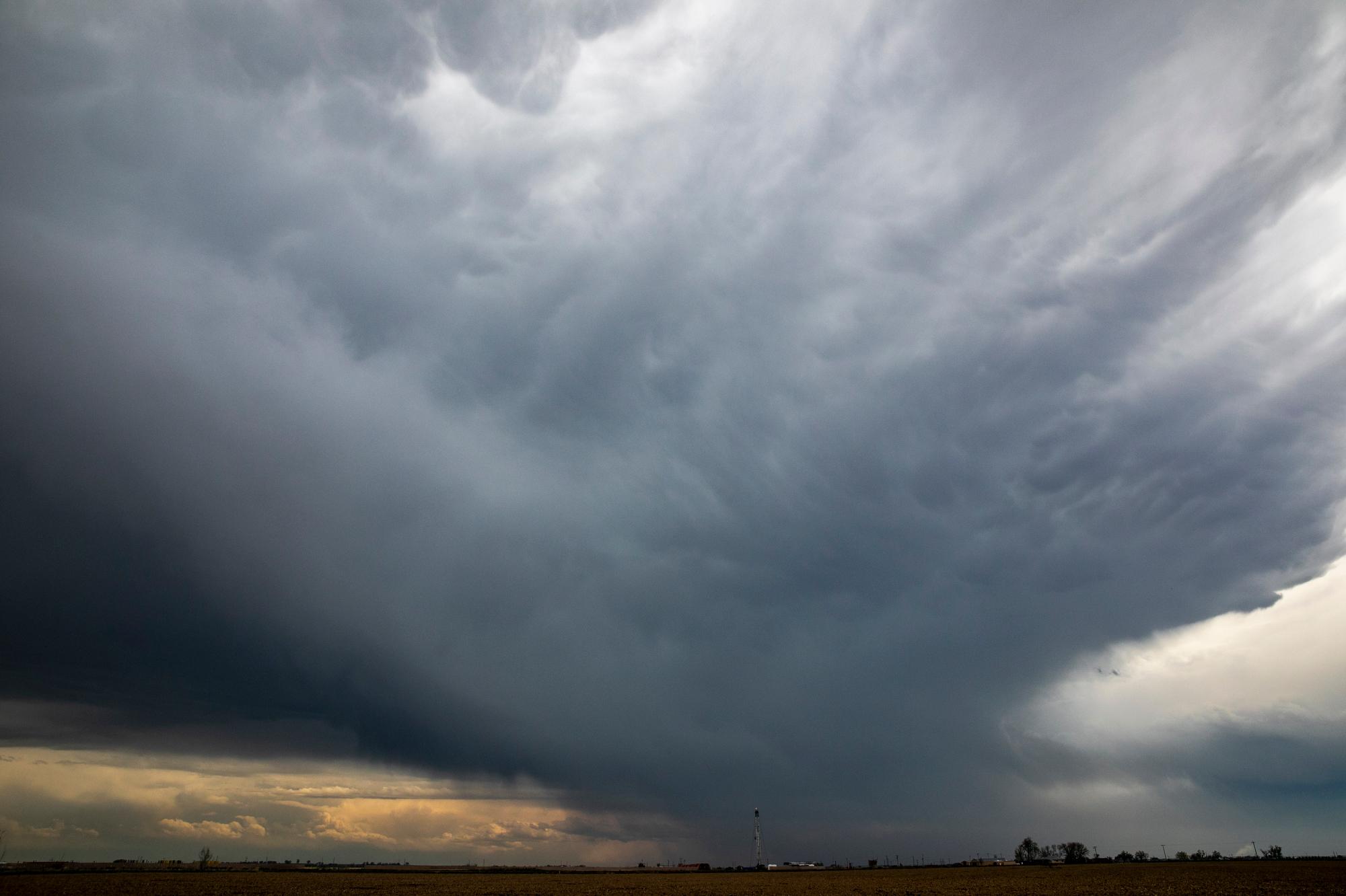
Tornado and flood activity continues in Colorado.
A flash flood warning was in effect for the Cameron Peak fire scar near Fort Collins Friday afternoon as well as a severe thunderstorm warnings for parts of the Denver metro – including Morrison, Arvada, Golden – and Jefferson County.
And flood warnings continue into Sunday for parts of Colorado and Weld Counties.
Much of the Eastern Plains and Southern Colorado are under severe thunderstorm watch until 7 p.m.
Meanwhile, two funnel clouds were spotted near Hartsel in Park County around 9:30 a.m. Friday.
National Weather Service meteorologist David Barjenbruch says these tornadoes are rare due to the time they were formed.
“Typically tornadoes don't occur until at least the noon hour and then into the early afternoon hours,” said Barjenbruch, who is based out of the NWS Office in Boulder. “This was definitely a rare event here (in Colorado). But we have had a couple of other funnels reported on the plains now as well.”
Another funnel was seen bouncing near farmland south of Strasburg in Elbert County at 11:40 a.m.
The funnels near Hartsel were also rare due to the elevation — 9,000 feet. Park County has only seen 8 tornadoes since 1950.
“It gets pretty tough to get tornadoes in higher elevations,” Barjenbruch said. “But they can and do occur.”
Barjenbruch said most thunderstorms often occur at a higher elevation than mountains – storm cloud themselves go up 40 to 50 thousand feet high — which makes tornadoes possible at elevation. However sometimes the bases of a storm occurs below the mountains.
“Terrain roughness sometimes has a breaking effect on tornado development. So, they're not as common in the foothills,” Barjenbruch said. “There's also generally not as much moisture, and there’s instability in the higher mountains. That is one other reason we get less tornadoes in mountains.”
Colorado owns the record for second highest tornado in the U.S. A 2012 tornado at Mt. Evans spun at 11,900 feet. The U.S. record is 12,500 feet in California’s Rockwell Pass.
Thunderstorm Watch in Colorado until 7 p.m. Counties include:
- Baca
- Bent
- Cheyenne
- Crowley
- Elbert
- El Paso
- Huerfano
- Kiowa
- Kit Carson
- Las Animas
- Lincoln
- Otero
- Prowers
- Pueblo
- Washington
- Yuma
The Front Range has been experiencing an unsettled weather pattern in recent week, but potentially happier weather is ahead for the holiday
Metro Denver, Northern Colorado and the Eastern Plains received hail from pea to tennis ball-sized Thursday.
Significant flash flooding occurred in Denver’s West Highland neighborhood and on Speer, a major artery for the city.
And I-25 flooded in several locations, leaving significant mud and debris that forced the closure of multiple lanes while crews cleaned up.
Barjenbruch says the region will have a quieter weather heading into the weekend.
“Tomorrow (Saturday) will be a drier day,” Barjenbruch said. “Though if you're looking forward to drier weather, only isolated storms should be confined either in the far northeast corner of the state or up in the mountains in the Park County area.”
A few more storms are forecast on Sunday and Monday. There is a threat of some thunderstorms becoming more active on the Fourth of July and Wednesday.