More than 10 years ago, Harriet Crittenden LaMair got an idea that turned into a life’s obsession. That idea – to remake and reconnect the 71-mile path that runs along the High Line Canal through metro Denver — might have seemed like a pipe dream back then. LaMair says early on, she and a group of land-use planners biked along the canal and saw first-hand how many areas had fallen into disrepair.
“Everyone had tires popping all over the place, and we didn't know where we were going. We got lost multiple times,” said LaMair. “So it was pretty wild.”
Today, if all of the pieces come together, the High Line Canal will one day be one of the longest continuous urban trails in the country.
The origins of the High Line date back nearly 150 years, when a British company saw an opportunity to make money. Tom Noel, a historian and professor emeritus at the University of Colorado Denver, says at the time, Colorado had a reputation as a place where outsiders could cash in.
“The British investment firm saw an opportunity to sell real estate, to sell ranches and farmlands, and also to bring water out there to the area of the great plains, which otherwise would not have been profitable for farmers and ranchers or even possible,” said Noel.
The canal's path begins at the South Platte River's Waterton Canon, travels northeast through what are now Douglas, Arapahoe, Denver and Adams counties, and ends just north of Green Valley Ranch — about five miles from Denver International Airport. In an article Noel wrote for History Colorado’s website, he describes the route as "traversing the socioeconomic mosaic of metro Denver from megamansions to low-income housing."
Noel said building the canal involved a complicated process to pull water downhill using gravity so it could reach the canal’s northeast end, but it never seemed to have enough water to serve its customers — especially farmers and ranchers toward the end.
“They were way down the list on what water would be provided, and often they couldn't provide it even in fairly wet years,” Noel explained. “So farmers and ranchers down the line were constantly suing them and complaining that the High Line Canal did not deliver.”
In the 1920s, the entity that would become Denver Water bought the canal for a little over a million dollars. Today, the High Line still actually delivers water to some customers, but in recent years, water hasn’t not flowed farther north than Hampden Avenue in Denver. Over time, Denver Water and other groups began to focus more on creating a path where people could walk, run, bike and recreate and less on water delivery.
Even so, many sections of the canal remained inhospitable for recreators, which led to the creation of High Line Canal Conservancy with Harriet LaMair as CEO and a mission to provide a continuous trail for metro area residents.
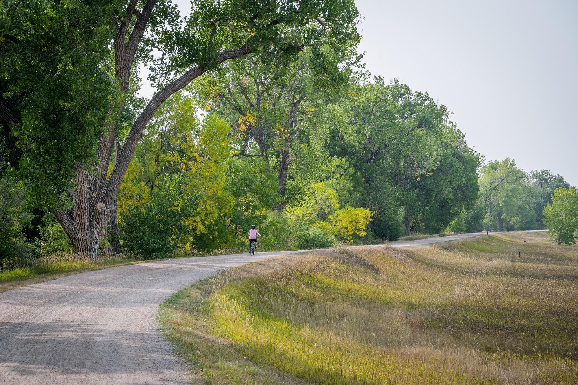
Some sections of the High Line — particularly in some of the southern sections of the canal's path – are already in good shape. These areas are home to wealthier residents and have had significant public and private investment over the years. The path is home to parks, pedestrian bridges and signage, and has a more defined tree canopy because that section of the canal has always had more water.
Other sections of the canal require significant investment, including busy urban sections in northeast metro Denver. In the last decade, millions of dollars in public and private dollars have gone into upgrades and maintenance. A $100 million, five-year plan led by the High Line Canal Conservancy, Denver Water and city and county governments along the route is underway. The Conservancy has raised $32 million for the effort. It still has to raise about $1 million more. The rest of the money will come from leveraging public dollars.
One example of the current effort is in the busy intersection at Colfax Avenue and Tower Road, where cars whiz by to the north, but to the south, visitors can look out onto vast open space, prairie grass and old cottonwood trees. The area has recently been paved and a major construction project is slated to be completed this year that will close a three-mile gap in the path with a wide trail and pedestrian bridges — including an overpass across I-70.
The Conservancy has worked to get buy-in and direction from local governments and residents who live along the path. Leslie Brown lives in Aurora and sits on the Conservancy’s Northeast Advisory Committee. Brown, who lives close to the canal’s path and has walked the entire 71 miles, said she fell in love with the trail when she discovered it.
“Why do you have to drive all the way to the mountains when there's this beautiful nature trail right in our backyard,” she said.
Brown said her priorities, which are part of the current plan, include more places for people to sit, better signs along the trail, more shelter to escape the hot sun and safer access for pedestrians.
“(There are) a lot of busy intersections and it's not … clearly marked. There's no actual crosswalk or anything, so it's very dangerous,” Brown said. “So if you're in a wheelchair, if you're a mom with a stroller … just making it smoother for everybody.
Related stories
- Public access to Hanging Lake and its trails will be limited this summer for trail reconstruction work
- The world’s longest track of dinosaur footprints has been hidden in Colorado’s mountains. Now, it’s public land
- What to know about Colorado’s hot springs and where to find them
- Outdoor recreation in southern Colorado is getting a boost from state grants
Brown said there is concern among residents in the area that these improvements could draw encampments similar to ones that have been set up in other parts of metro Denver, and that people might be tempted to camp overnight or use the new seating areas for sleeping. LaMair said she and local governments are trying to figure out how to address that.
Among the other planned improvements is the creation of a stormwater filtration system, which would funnel stormwater into the canal bed to be naturally cleaned before it makes its way to other waterways. Planners say that could also bring water into the dry sections of the canal.
Also, two major gaps in the canal — including the I-70 crossing — will be closed to make them walkable. In all, there are 30 ongoing projects at different sections of the trail which should be complete within the next five years.