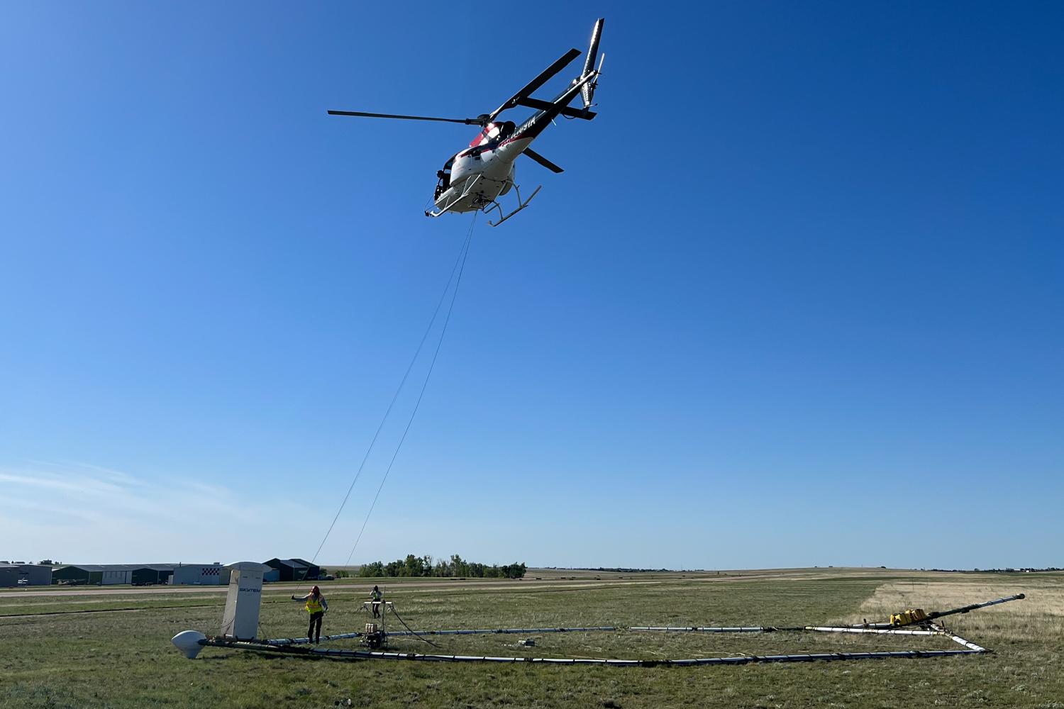
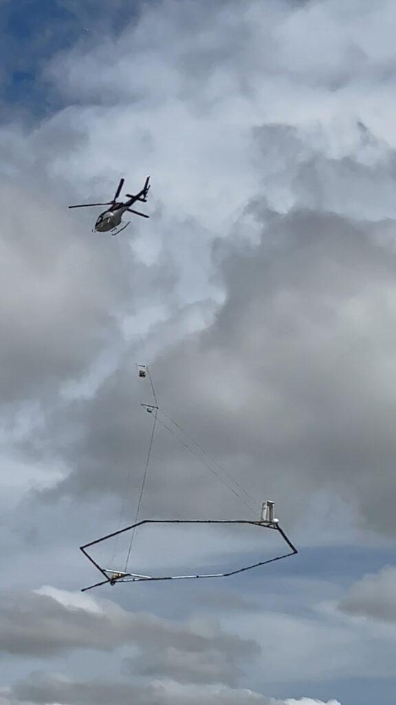
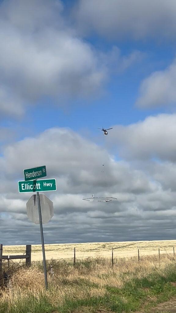
A helicopter flying at 55 miles per hour, with an 85-foot-diameter sensing device dangling below it, crisscrossed the Upper Black Squirrel Creek Groundwater Management District earlier this month. The area lies east of Colorado Springs and includes Falcon, Peyton and Ellicott.
The specialized device can sense some 2,000 feet into the earth to see changes in the electrical properties that help determine what types of minerals, rock, soil and water resources lie beneath the ground. That’s according to Jared Abraham, a principal geophysicist with Aqua Geo Frameworks, the Wyoming company conducting the project for the district.
Abraham said they’ll combine the data collected by the helicopter with existing well records and other information to chart the area’s underground geology and water resources.
“This is not magic,” he said. “If it was magic. It would be a lot easier. It is one way of looking at the Earth. We cannot discard our traditional geology and hydrology.”
The aerial sensing system is formally known as airborne electromagnetic (AEM) surveys. The technology it’s based on first emerged after World War II when it was used to hunt for submarines, according to Abraham. Many advances have occurred since then to allow it to work for a project like this one.
“It does not replace drilling test holes and doing aquifer tests,” Abraham said. "It helps focus that (work) in a much more efficient manner.”
It’ll take a few months to process and analyze the data, he said. Then they’ll generate three-dimensional maps of the area’s underlying geology and produce a detailed report later this year.
The district's water comes from an alluvial aquifer, the material left behind and created when ancient glaciers melted, Abraham said.
The district commissioned the $400,000 study because of concerns about how fast the area is developing. District president Dave Doran said the report will help address the region's rapid shift from agricultural to suburban uses.
“Our concerns have been that we know that there aren't enough water resources for the projected growth and even the growth that we're seeing right now,” he said. “We have no surface water in our basin and it's a 354-square-mile basin. More metro districts are forming and large subdivisions are being put in, but their reliance is totally on non-renewable, Denver Basin aquifer water, which are the deeper aquifers that underlie our basin.”
The aerial mapping is a game changer for the district according to Doran, because among other things, it’ll be a tool to help them find places where they could pump water back into the alluvial aquifer.
“We would have to drill a million holes to figure out where the most ideal locations are,” he said. “This 3-D mapping joins (the existing) well locations we have and it gives us a picture in between all those.”
The study will also help guide potential stormwater management and planning, according to Doran. “We need to find a better location to be able to take advantage of storm events to be able to use that (water) source,” he said, “and not let it just run fast through the basin with very little recharge to our aquifers.”
Doran said they’ll use the study to work with local metropolitan districts and developers to find ways to sustainably use and recharge the district’s water aquifer.
“It's not a panacea,” he said, “but it sure answers a lot of questions.”
Abraham’s company has previously used a similar airborne mapping system in the South Platte and San Luis Valley Basins, as well as in other states.