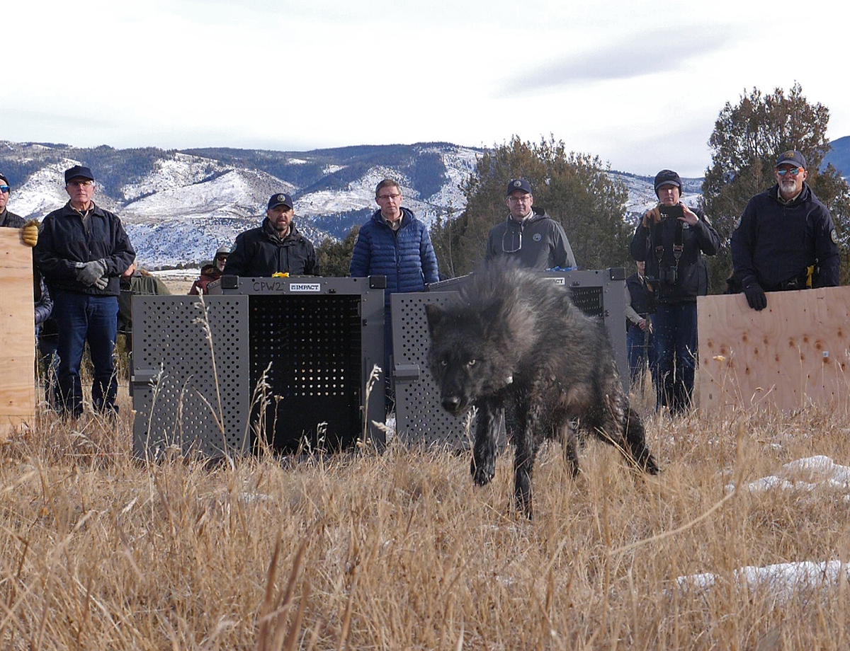
It’s been more than a month since Gov. Jared Polis popped open a set of crates holding wolves from Oregon, kicking off the state’s voter-approved effort to restore a viable population of predators to Colorado.
A new map released by Colorado Parks and Wildlife on Wednesday provides a clearer picture of wolf activity since then. It suggests the 10 predators — along with two previously collared wolves — have visited a broad territory centered around Kremmling, Colo, including Jackson, Routt, Eagle, Summit and Grand counties.
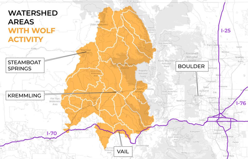
No one expected the 10 animals recently let loose in Grand County to stay near the release location. Wolves have been known to travel up to 140 miles immediately after arriving on a new landscape, which means they could have bolted to new habitats almost anywhere across the state.
It now appears the new arrivals have not made a break for the Front Range or any state border. The range of Colorado wolves currently includes about 4,500 square miles of the Western Slope but doesn’t span east of Granby, south of Vail or west of Glenwood Springs.
Not every place highlighted on the map is necessarily a hotbed for Colorado’s latest lupine residents, either.
The map shows 23 watersheds where at least one wolf entered from Dec. 18, 2023, to Jan. 22, 2024. As a result, the data doesn’t indicate that wolves are currently in a highlighted watershed and aren’t necessarily present throughout the entire area.
That means wolves have likely ventured over a smaller territory than the map suggests. For example, wolves haven’t traveled south of Interstate 70, but a wolf has visited a watershed spanning both sides of the highway.
It turns out the lack of clarity is intentional. Colorado wildlife officials are keeping detailed GPS data secret due to concerns the information could be used to illegally track and kill the predators. Colorado wildlife officials say their public disclosure approach is specific enough to alert farmers and ranchers to the presence of wolves without giving away the exact location of any individual animals.
All 12 known wolves in Colorado have functional GPS collars, according to Colorado Parks and Wildlife. That includes the 10 predators released in Grand County and two members of a pack that’s been living in Jackson County for years after naturally migrating from Wyoming.
The agency expects the maps will become less accurate over time due to a simple reality: New wolf pups aren’t born wearing location collars. As the population multiplies, the state will lose its ability to carefully track the boundaries of the species’ range.
The latest mapping efforts appear to address those concerns about the secrecy surrounding the initial release last month.
Colorado Parks and Wildlife did not inform nearby ranchers or residents before putting “paws on the ground.” The cloak-and-dagger operation stunned livestock producers, who later blasted the agency for failing to uphold a commitment to a transparent reintroduction process.
The agency now plans to update the map on a monthly basis to keep the public aware of potential wolf activity, but officials say it might delay the information during sensitive periods like mating season.